Gaumukh Tapovan Trek
- Home
- Gaumukh Tapovan Trek
Gaumukh Tapovan Trek
Trek Location
Duration
Explore Tours
A Short Briefing of Gaumukh Tapovan Trek
Gaumukh, which means ‘cow’s mouth,’ is the place where Maa Ganga emerged from for the whole of India. Here, you can have a spiritual and natural experience. The weather and route of this Tapovan Trek tell you what the real challenges are on the trek. It is one of the most recommended treks in Uttarkashi; the beauty of the Gaumukh Tapovan trek makes it special from others.
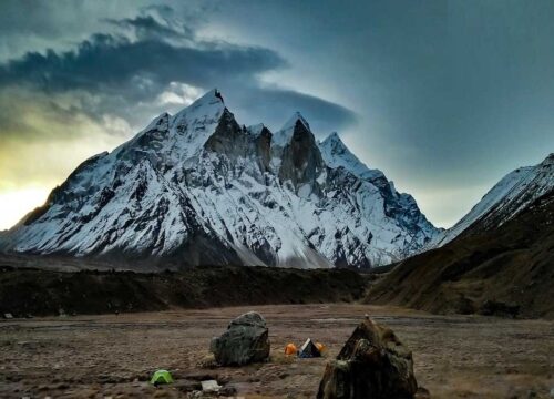
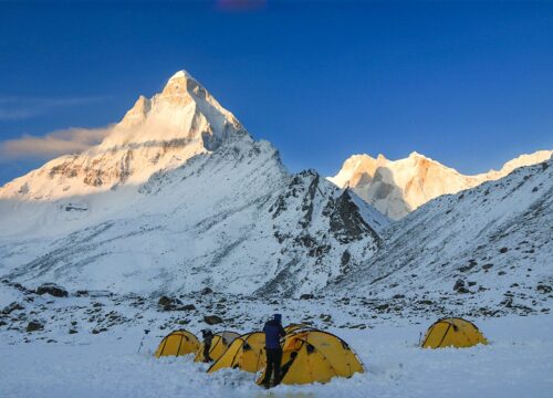
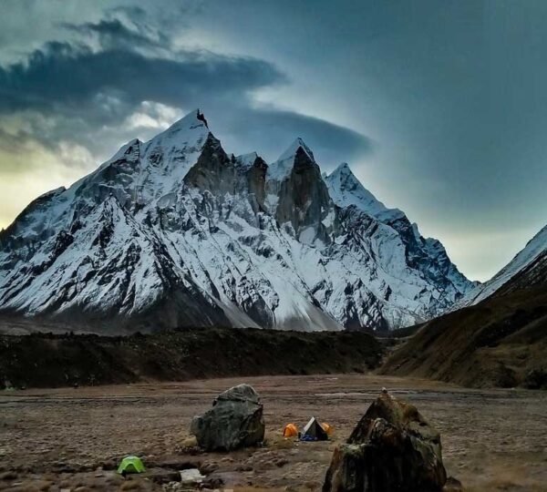
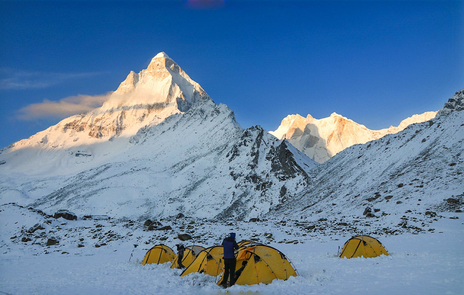
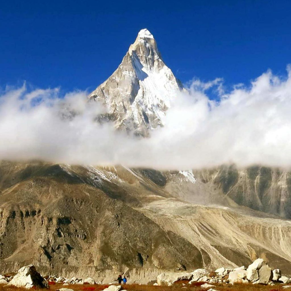
This Gaumukh Tapovan starts from the base at Gangotri, where the pilgrim village is settled by Pandits (priests). This is a trekking journey in the Gangotri Gaumukh range with huge glaciers, high peaks, and a flat base camp. Maa Ganga originates from Gaumukh, where you can see drops of melting glacier and the saying (बूंद बूंद से घड़ा भरता है) coming true. Bhagirathi Ganga flows along with you and guides you throughout the trek. At the Camp of Tapovan, you will see Mount Shivling in the front of your eye in a triangle shape, and the Bhagirathi I, II & III form a magnificent mass. 
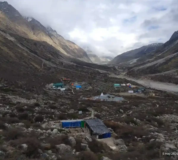
Overview of Gaumukh Tapovan Trek
Total Distance and Duration:
Approximately 20 km | 5 Days
Highest Altitude Reached:
Tapovan at around 4,463 meters (14,640 ft)
Difficulty Level:
Moderate to difficult trek, suitable for experienced trekkers, but even beginners can do it by practicing and exercising before the trek.
Visible Peaks From Tapovan
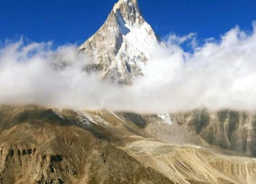
Mount Shivling
Bhagirathi 1, 2, & 3
Sudarshan
Meru
Kedar Dome
Gangotri Glacier
Chaturangi Glacier
What can you expect from this Gaumukh Tapovan Trek?
The Gaumukh Tapovan Trek is an unforgettable journey through the landscape of the mountains. When you set out on this adventure, you can expect the following:
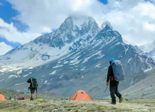
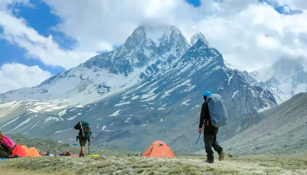
Beautiful Scenery: This Gaumukh Tapovan Trek takes you through the green meadows and rocky terrains. It will conclude with amazing views of the Gaumukh Glacier and the majestic peaks surrounding Tapovan.
Wildlife Sightings: Keep your eyes out for the various plants and animals. You might spot Himalayan black bears, musk deer, and various bird species along the trails.
Places To Explore in Gangotri Before & After Gaumukh Tapovan Trek
- Maa Ganga Temple: On the basis of the Char Dham Yatra, Gangotri is the fourth Dham in Uttarakhand, the home of Maa Ganga. Every year after the Deepawali festival, Gangotri temple gates close until April-May on the auspicious day of Akshay Tritiya.
- Amar Singh Thapa, a Nepali general, built the first Gangotri temple around the 18th century. The Gangotri Temple was built in Nagara style, and the King of Jaipur rebuilt it.
- Bheem Gufa (Cave): This cave is dedicated to the 5 Pandavas who were in search of heaven after the Mahabharata war.
- Surya Kund: When the sun rises in Gangotri, the first ray of the sun falls on the Surya Kund. There is a Shivlinga at the bottom of the Surya Kund, which becomes visible during winters when the Gaumukh glaciers slowly melt, and the flow of the River Ganga becomes normal.

Safety and Assistance During Gaumukh Tapovan Trek.
Safety on the trek is our priority, and here is how to ensure a safe trekking experience during the Gaumukh Tapovan trek.
Experienced guides: Our certified guides are trained in guidance and first aid and are well-experienced in the Himalayan region. They will lead the group, and you must follow their instructions to stay safe on the trek.
Briefing before the trek: We conduct a briefing session to discuss safety protocols, itinerary, etc.
Emergency assistance: Our guides and trek leaders carry a first aid kit and communication equipment for any emergencies. In case of altitude sickness or any other health issue, we have protocols in place to ensure immediate assistance.
15 Trekkers Group: We form a manageable group size to ensure each trekker gets the attention and assistance he needs.
Weather Reporting: Our Base Camp team monitors weather conditions to make informed decisions regarding the trek’s safety.
FAQ
What is the best season to do the Dayara Bugyal Trek?
The best time is April to June for greenery and flowers and December to February for snow views and skiing.
Do I need prior trekking experience?
No prior experience is required. It’s a beginner’s trek, but basic fitness is recommended.
What permits are required for Dayara Bugyal?
You need a forest entry permit and local authority permission, which we arrange for the trekkers.
Is this trek best for children and senior citizens?
Yes, children and senior citizens can do this trek.
How cold does it get during the trek?
Temperatures range from 10°C during the day to -5°C at night, especially in winter.
Can I rent trekking gear from you? (Shoes, Trek pole, jackets, pants, etc.)
Yes, we provide all the rental gear like Gaitors, Spikes, Shoes, pants, jackets, etc.
How to reach Mountain Paradise,s Base Camp?
Reach Prince Chowk, Dehradun by Flight, bus, or train from there. Our team will pick you up at our Base Camp.
Essential Items You Must Carry
Clothing:
Base Layers: Moisture-wicking t-shirts and thermal tops Insulating Layer: Fleece or down jacket for warmth Outer Layer: Rain Court and windproof jacket Trekking Pants: Quick-dry and comfortable pants Warm Hat and Gloves: Essential for colder temperatures Socks: Wool or synthetic trekking socks (multiple pairs) Trekking Boots: Sturdy, waterproof boots with good ankle supportGear:
Backpack: A comfortable, lightweight backpack (40-60 liters) Trekking Poles: Helpful for stability on uneven terrain Headlamp/Flashlight: With extra batteries Water Bottle: To stay hydrated Personal Items: First Aid Kit: Include basic medications and supplies Sunscreen and Lip Balm: Protect against UV rays Insect Repellent: To ward off bugs Toiletries: Biodegradable soap, toothbrush, toothpaste, etc. Camera: To capture the stunning scenery (optional) Food and Snacks: Energy Bars and Trail Mix: For quick energy boostsTrek Itinerary
Duration: 7 Hours
Distance: 12 km
Altitude: 12,415 ft Hours
Begin the relatively short trek to Bhojbasa; the trail continues along the Bhagirathi River, offering a gradual ascent with minimal altitude gain. From forest area to open, rocky terrain as you approach the Gangotri Glacier's influence. The Bhagirathi peaks dominate the skyline, creating a stunning backdrop.
Highlights: View of Bhagirathi Peak, Camping near Maa Ganga River.
Accommodation: Camping Tents and Sleeping Bags, Food, Toilet tents etc.
Duration: 9 Hours
Distance: 6.5 km
Altitude: 14,203 ft
The first leg of the 150m crossing trolly to Gaumukh Tapovan, then 5 km to Gaumukh, usually a flat trail, but on this day, we head directly to Tapovan instead of Gaumukh (Cause of Weather, timing and the group pace coordination). The last steep trail patch of Tapovan is 1.5km, Which is mostly difficult for many trekkers(Consult with our expert team).
Highlights: Shivling Parvat, 80% Chance to spot Bharal Sheap and the Akaash Ganga
Accommodation: Camping Tents and Sleeping Bags, Food, Toilet tents etc.
Duration: 7 Hours
Distance: 8 km (round trip)
Altitude: 14,755 ft
Trek to Meru Glacier, a less visited but spectacular extension of the Gangotri Glacier system, located near Mt. Meru; the trail involves navigating rocky moraine and gentle slopes, with some requiring scrambling over boulders. The route offers close-up views of Meru Peak and the surrounding ice formations. Spend time at the glacier, capturing photographs of the raw beauty of the Himalayas wilderness.
Highlights: Close view of Mt. Meru, Tapovan's Peaceful meadow with vibrant wildflowers (in season).
Accommodation: Camping Tents and Sleeping Bags, Food, Toilet tents etc.
Duration: 5 Hours
Distance: 6 km
Altitude: 12,415
Start the day early with breakfast and begin the descent to Bhojbasa, retracing the path via Gaumukh. The initial descent from Tapovan is steep and requires caution on loose rocks and scree. Reaching Gaumukh Glacier, spend time one and a half hours at the Source of Maa Ganga (Gaumukh), and after that, continue to the next destination, which is Bhojabasa.
Highlights: Scenic descent with Himalayan vistas, visiting Gaumukh and a relaxing campsite in Bhojbasa.
Accommodation: Camping Tents and Sleeping Bags, Food, Toilet tents etc
Duration: 5 hours
Distance: 12 km
Altitude: 10,050 ft
Begin the final day with our packed lunch and start the descent to Gangotri. The trail is mostly downhill; passing through pine tree forests path will be familiar and easier to return. Reflect on the trek's spiritual and adventurous highlights as you approach Gangotri.
Highlights: After departure, trekkers can visit Lanka Bridge(Asia's Highest bridge), Harshil Valley and Sukhi Top.
Accommodation: Camping Tents and Sleeping Bags, Food, Toilet tents etc.